Uttarkashi Flash Flood Mystery: ISRO Satellite Images Uncover Shocking Clues Behind Disaster
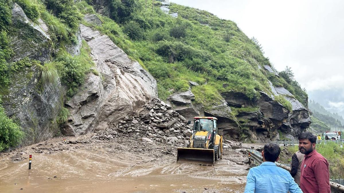
Uttarkashi is still reeling from a devastating mudslide that killed five people and left over 50 missing in the Dharali area. As rescue teams race against time, experts are scrambling to answer one urgent question — what triggered this deadly flood?
Surprisingly, the answer may lie in the region’s unique geology, melting glaciers, and the growing impact of climate change.
Built on Fragile Ground
Uttarkashi Flash Flood Mystery : According to a detailed report, Dharali village sits on an “alluvial fan” — a cone-shaped formation made up of debris from previous floods at the confluence of the Kheer Ganga stream and the Bhagirathi River.
Though the village is located about 200 metres from the river, commercial construction has crept dangerously close to this unstable formation, making it more vulnerable to disasters.
Theory 1: The Return of an Old Landslide
One strong theory is that the mudslide was caused by a reactivated landslide. A glaciologist pointed to an old landslide site just 2 kilometres uphill from Dharali that may have been triggered again.
A study by Bhambri Retal., High Mountain Hazards in Uttarakhand, backs this up. It found that after the massive June 2013 rainfall in the Bhagirathi Basin, 533 old landslides were reactivated, with areas like Bhatwari, Pilang, Dharali, and Tehri dam hit hardest. The region’s geology, steep slopes, and unpredictable weather make it prone to such disasters.
Theory 2: A Breached Glacial Lake
Uttarkashi Flash Flood Mystery : Another possibility is a glacial lake outburst flood (GLOF). Using satellite data, glaciologists spotted two glaciers with huge crevasses about 7 km above Dharali. These cracks could be accelerating melting.
Below them lie seven small lakes. Experts believe rising temperatures may have caused one lake to breach, releasing a destructive flow of water, rock, and debris (moraines) downstream — explaining the sheer force of the flood.
ISRO’s Eye in the Sky
Uttarkashi Flash Flood Mystery : ISRO satellite images have revealed the true scale of the disaster. Photos of Dharali taken before and after the event — especially on August 7, 2025 — show massive mud and sediment deposits where the Bhagirathi and Khera gad Rivers meet, clearly capturing the aftermath of the cloudburst.
Theory 3: Rain Instead of Snow
A third theory involves a weather twist. One scientist suggested an “orographic barrier” effect — where a 5,700-metre-high mountain peak blocked moisture-filled clouds, forcing them to dump heavy rain instead of snow over upper regions.
This could have triggered floods in Kheer Ganga, Harsil, and Sukhi top — affecting more than just the glacial catchment area.
A Himalayan Warning
Uttarkashi Flash Flood Mystery : Whether it was a reawakened landslide, a breached glacial lake, or an extreme rain event, one thing is clear: this tragedy is a wake-up call about the fragile Himalayan ecosystem. With climate change and reckless development adding to the risk, urgent action is needed to prevent the next disaster.
1. What caused the Uttarkashi flash floods in Dharali?
Experts believe the disaster may have been triggered by a combination of factors — a reactivated old landslide, a possible glacial lake outburst, or extreme rainfall caused by an orographic barrier. ISRO satellite images and geological studies are being used to pinpoint the exact cause.
2. What is an alluvial fan, and why is Dharali at risk?
An alluvial fan is a cone-shaped deposit of sediment created by past floods. Dharali is built on such a formation at the confluence of the Kheer Ganga stream and Bhagirathi River. This unstable landform makes it highly vulnerable to landslides and floods, especially when commercial development encroaches on it.
3. How do glacial lake outburst floods (GLOFs) happen?
A GLOF occurs when a glacier-fed lake suddenly breaches, releasing huge volumes of water, rocks, and debris downstream. In Dharali’s case, melting caused by rising temperatures could have triggered such a breach, leading to the destructive flash flood.
4. What did ISRO’s satellite images reveal about the disaster?
ISRO’s before-and-after satellite images, including one from August 7, 2025, showed heavy mud and sediment deposits near the Bhagirathi and Khera gad Rivers. These images provide visual evidence of the flood’s massive impact on Dharali.
5. How is climate change linked to the Uttarkashi floods?
Climate change accelerates glacier melting, increases extreme rainfall events, and destabilizes mountain slopes. In regions like Uttarkashi, this means a higher risk of flash floods, landslides, and other extreme weather-related disasters.


